Create a Well
A Well is the top-level physical entity in GeoMaster, its title, operator/owner, surface location, and elevation.
A Well is the top-level physical entity in GeoMaster — its title, operator/owner, surface location, and elevation. Each well can have one or more wellbores, and a Project is always built on top of a specific wellbore. You need at least one well (and a wellbore under it) before you can create a project.
Where to Create a Well
There are two entry points, and both open the same Create Well dialog:
-
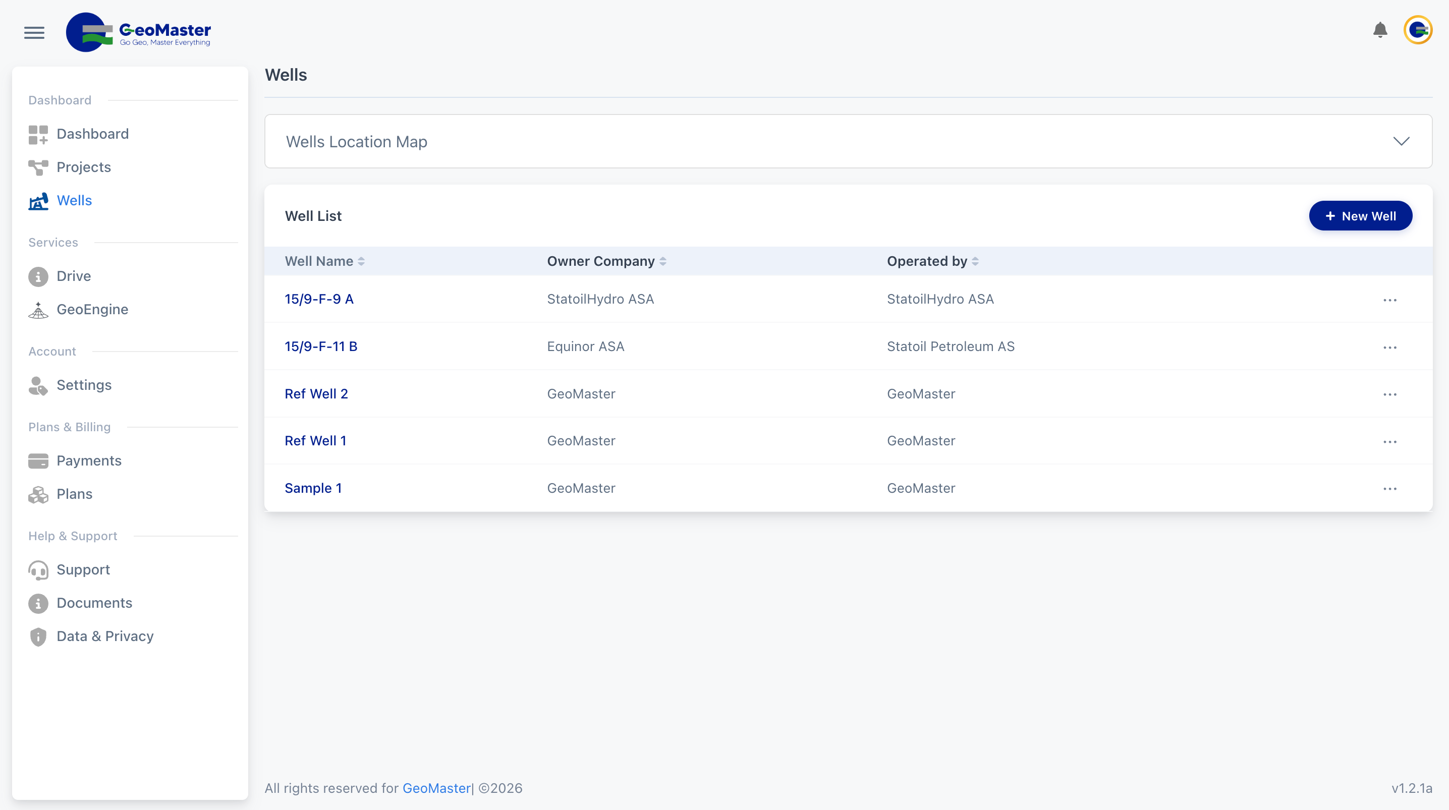
From the Wells page — go to Wells in the left sidebar (
/wells), then click New Well in the top-right of the Well List card. -
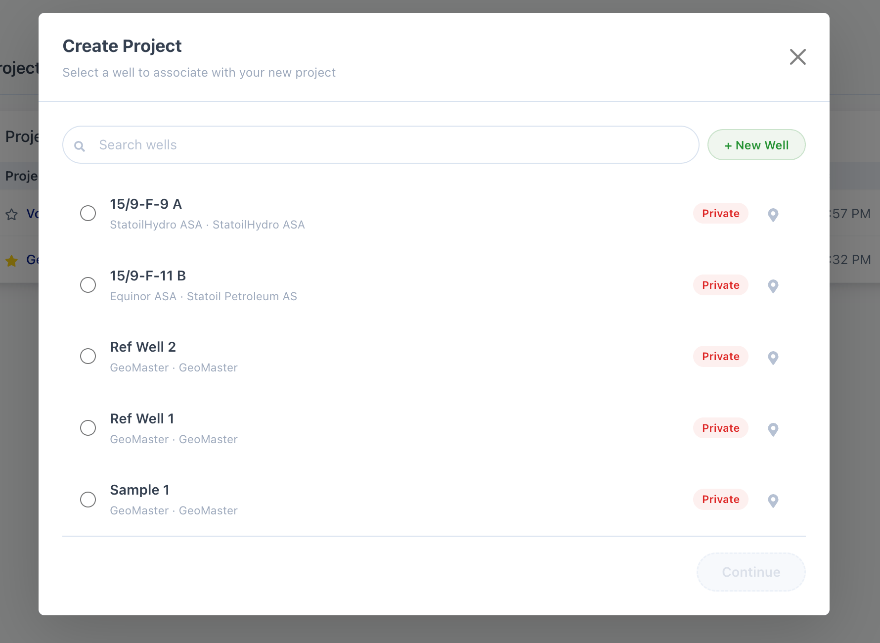
While creating a project — when you click New Project on the Dashboard, GeoMaster asks you to attach a well. Click + New Well (or Create New Well if you have no wells yet) inside that picker.
The Create Well Form
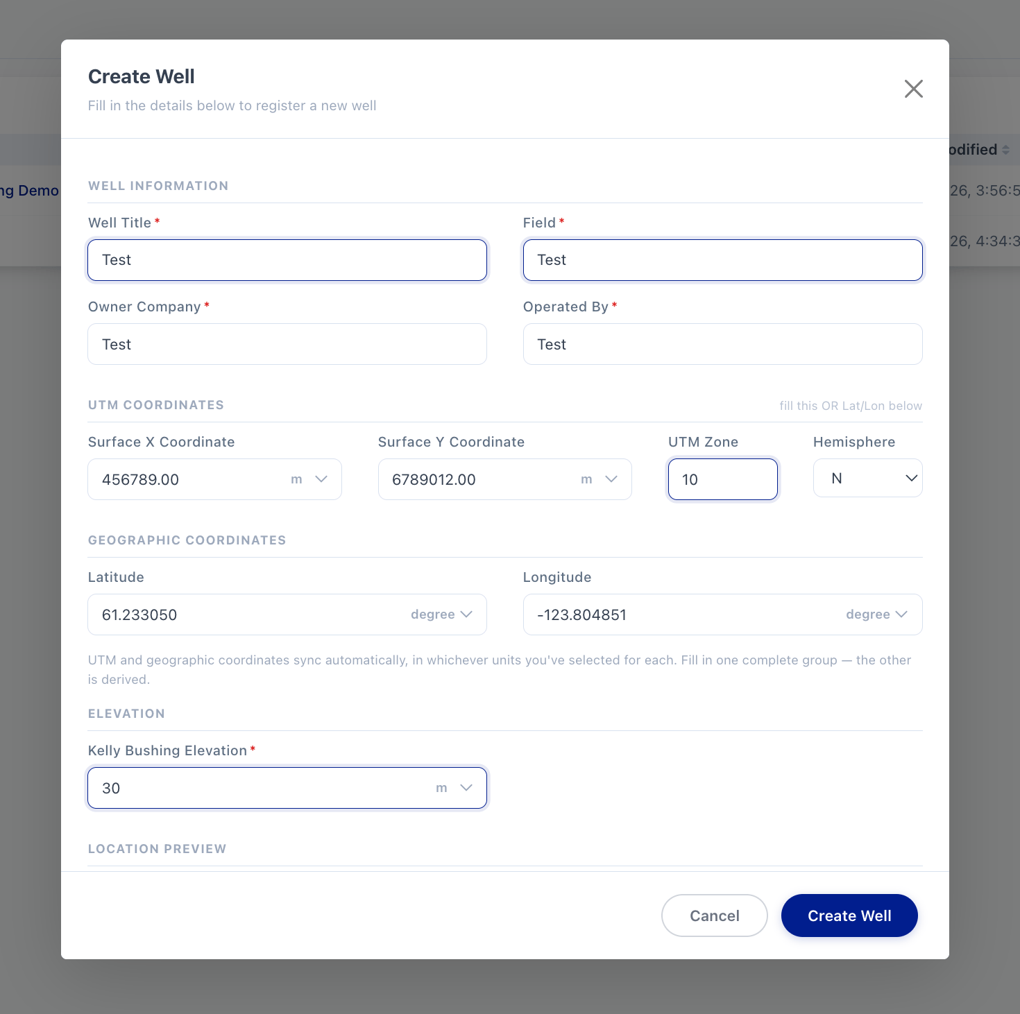
The dialog is titled Create Well ("Fill in the details below to register a new well") and is organized into four sections.
1. Well Information
| Field | Required | Notes |
|---|---|---|
| Well Title | Yes | e.g. "North Sea Alpha-1" |
| Field | Yes | e.g. "Forties Field" |
| Owner Company | Yes | Type-ahead search |
| Operated By | Yes | Type-ahead search |
Owner Company and Operated By are search boxes, not free text:
-
Start typing and matching organizations appear in a dropdown (a green ✓ verified tag marks verified organizations).
-
Click a result to select it.
-
If nothing matches, an option appears at the bottom of the list reading + Add "your text" — click it to create that organization on the fly and select it immediately.
2. UTM Coordinates _or_** Geographic Coordinates**
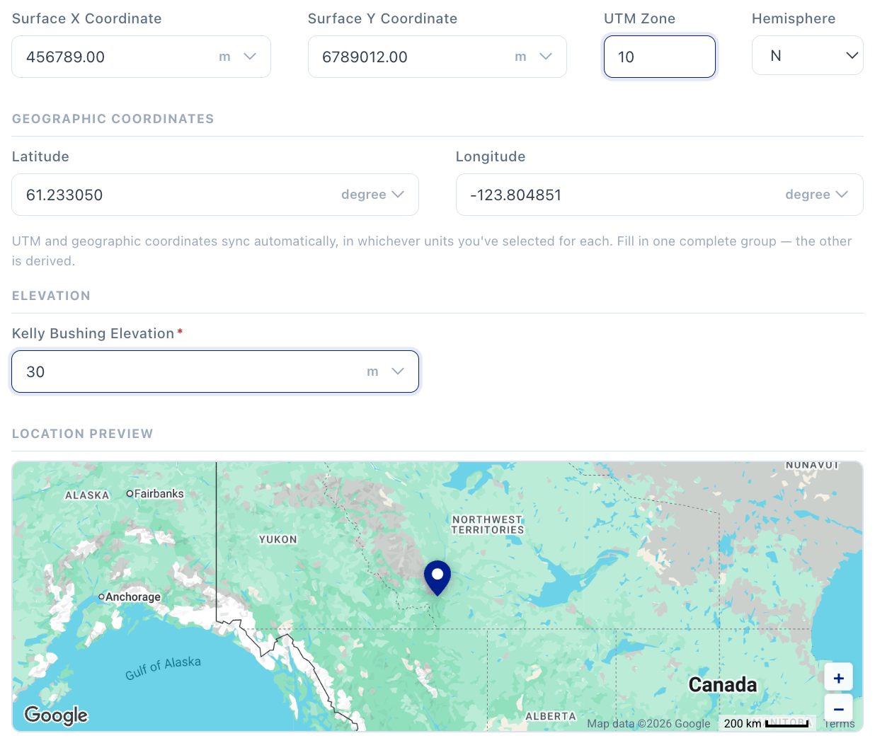
You must fill in one complete position group — either UTM or Latitude/Longitude:
UTM Coordinates
| Field | Notes |
|---|---|
| Easting (X) | Numeric, has its own unit-of-measure dropdown |
| Northing (Y) | Numeric, has its own unit-of-measure dropdown |
| Zone | 1–60 |
| Hemisphere | N or S |
Geographic Coordinates
| Field | Notes |
|---|---|
| Latitude | Numeric, has its own unit-of-measure dropdown; valid range −90 to 90 |
| Longitude | Numeric, has its own unit-of-measure dropdown; valid range −180 to 180 |
These two groups sync automatically — enter a UTM position and the Lat/Lon fields update live (and vice versa), converting through whatever unit you've selected on each field. You only need to fill in one group; leave the other blank and let it derive.
If neither group is complete when you submit, the form shows: "Enter a complete UTM position (Easting/Northing/Zone/Hemisphere) or a complete Latitude/Longitude position."
3. Elevation
| Field | Required | Notes |
|---|---|---|
| Kelly Bushing Elevation (KB) | Yes | Numeric, has its own unit-of-measure dropdown |
4. Location Preview
A small live map appears at the bottom of the dialog and drops a pin as soon as you've entered a valid position (from either UTM or Lat/Lon) — use it to sanity-check you didn't transpose a coordinate.
Saving
Click Create Well at the bottom of the dialog.
-
If this is the well's first wellbore, GeoMaster automatically creates a default wellbore for it (matching the well's name) and shows a toast: "We created the original wellbore '<name>' — you can rename it from this well's Wellbores list."
-
You're returned to wherever you started — the Wells list, or straight into well/wellbore selection if you were creating a project.
Editing or Deleting a Well
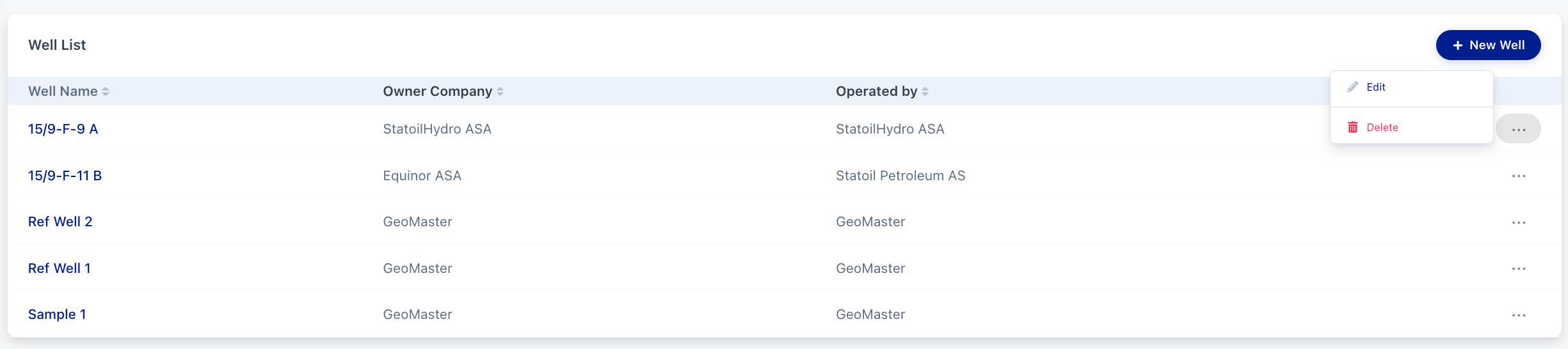
On the Wells page, each row in the Well List table has a ⋯ menu on the right with two actions:
-
Edit — reopens the same Create Well dialog (titled Edit Well), pre-filled with the current values, so you can update any field including position and elevation.
-
Delete — opens a confirmation dialog ("Well '<title>' will be deleted. Are you sure?"). Click Ok to permanently delete the well, or Cancel to back out. This cannot be undone.